Hike around Gollenberg

Hiking tours
Length: 5 km
0 Ratings of 5 (0)
0
0
0
0
0
How did you like your stay? You have already rated your stay.
Hiking tours
Length: 5 km
From €
Show availability & price

p.P. = per person, p.P./N = per person / night, p.E./N = per unit / night, EZ = Single room, DZ = double room, FeWo = holiday home, App. = apartment, Suite = suite, FR = Breakfast, HP = half board, VP = full board
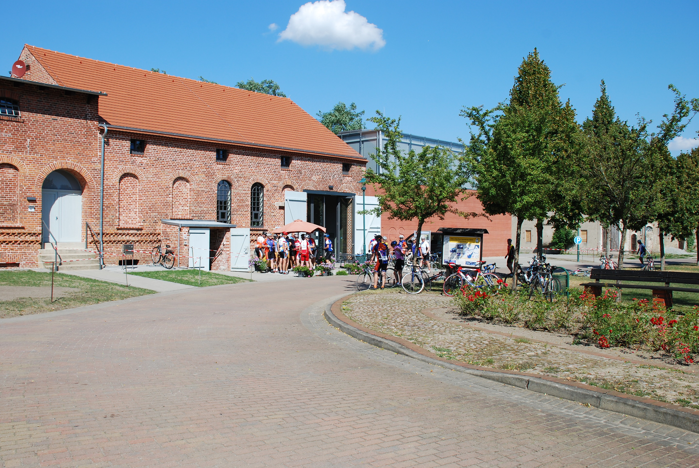
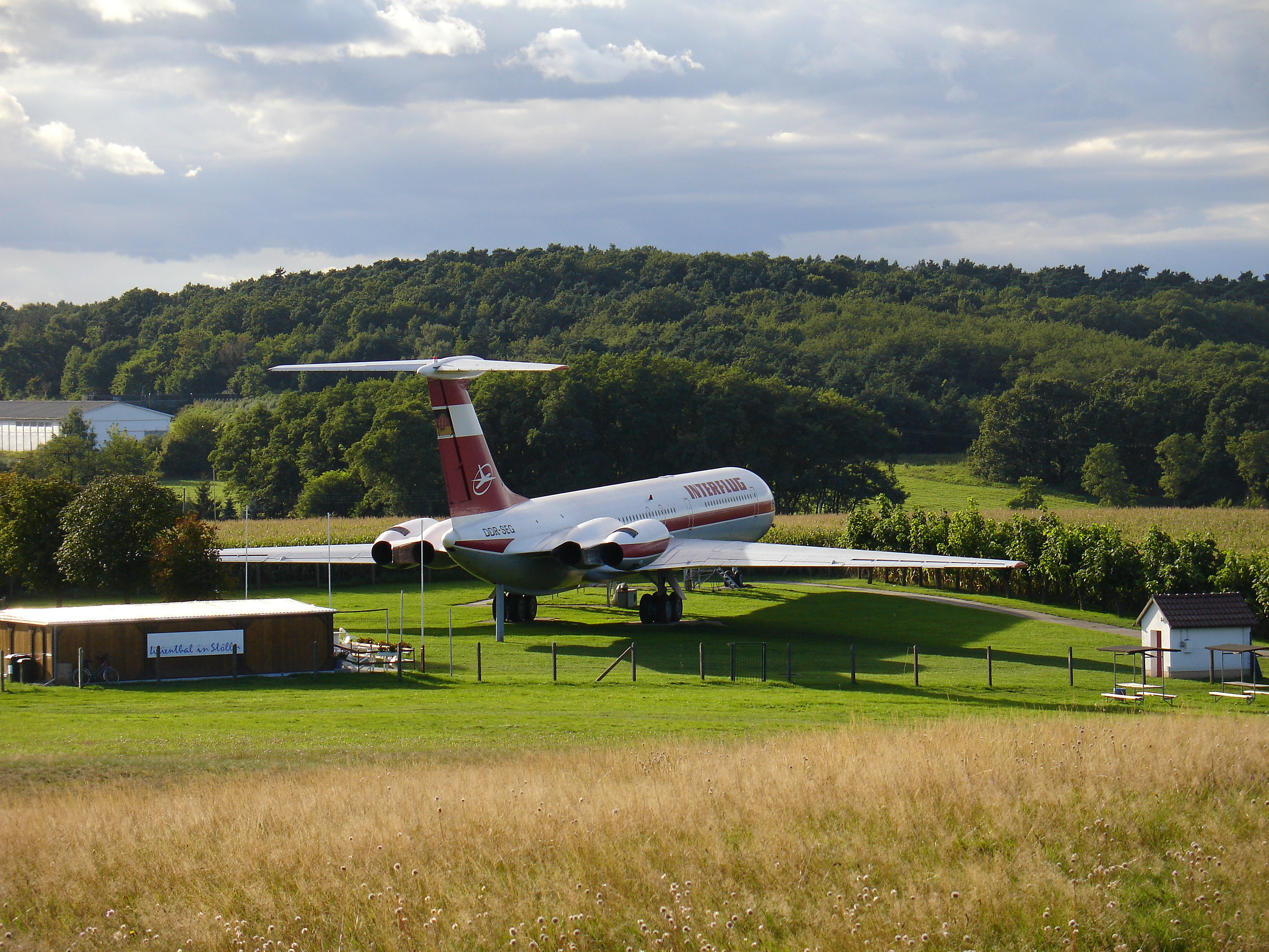
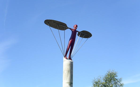
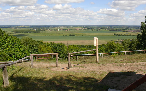
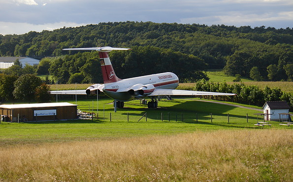
Following in the footsteps of the pioneer of aviation, you can get from the Lilienthal Centre at the heart of the town and through the new landscape park directly to Gollenberg. There are wonderful vantage points and sculptures to be seen along the way. On the top of Gollenberg, the “wind harp” towers into the sky – a unique monument at Lilienthal's historic jump-off point. Here at the Lilienthal sculpture you can enjoy a magnificent view of the expansive Rhin and Dosseniederung lowland landscape with its historic colonist villages. The memorial stone to Otto Lilienthal is located directly at the crash site on the northern slope of Gollenberg. In addition to the IL 62 aircraft with the Interflug exhibition, you will find natural paths here that are perfect for a walk or a hike.
Continue readingcollapse
  • Foto: Tourismusverband Havelland e.V.
  • Foto: Tourismusverband Havelland e.V.
  • Foto: Tourismusverband Havelland e.V.
  • Foto: Tourismusverband Havelland e.V.
Length: 5 kilometres (1 hour)

Start/finish: Stölln

Logo/route sign: not specified

How to get there: Take the RE4 from Berlin central station (Hauptbahnhof) to Rathenow. From here, take bus 687 (Friesack) to Stölln (approximately 2 hours).

Sights:
  • Lilienthal-Centrum Stölln
  • Dorfkirche Stölln
  • Gutspark Stölln
  • Flugsportverein "Otto Lilienthal" Stölln/Rhinow e.V.
  • Stölln and aviation pioneer Otto Lilienthal


Possible combinations:

  • Havel-Elbe Hiking Trail conditions/surface:


Trail conditions/surface: not specified

Maps/Literature:

  • Leisure map “Naturpark Westhavelland-Nord”, 1:50.000, Landesvermessung und Geobasisinformation Brandenburg, edition: Neuauflage. (1. November 2012), ISBN-13: 978-3749040797, Euro 6
  • “Naturpark Westhavelland Süd: Topographische Freizeitkarte", 1:50.000, Landesvermessung und Geobasisinformation Brandenburg, Auflage: Neuauflage. (1. November 2012), ISBN-13: 978-3749040803, Euro 6

Continue readingcollapse
Following in the footsteps of the pioneer of aviation, you can get from the Lilienthal Centre at the heart of the town and through the new landscape park directly to Gollenberg. There are wonderful vantage points and sculptures to be seen along the way. On the top of Gollenberg, the “wind harp” towers into the sky – a unique monument at Lilienthal's historic jump-off point. Here at the Lilienthal sculpture you can enjoy a magnificent view of the expansive Rhin and Dosseniederung lowland landscape with its historic colonist villages. The memorial stone to Otto Lilienthal is located directly at the crash site on the northern slope of Gollenberg. In addition to the IL 62 aircraft with the Interflug exhibition, you will find natural paths here that are perfect for a walk or a hike.
Continue readingcollapse
  • Foto: Tourismusverband Havelland e.V.
  • Foto: Tourismusverband Havelland e.V.
  • Foto: Tourismusverband Havelland e.V.
  • Foto: Tourismusverband Havelland e.V.
Length: 5 kilometres (1 hour)

Start/finish: Stölln

Logo/route sign: not specified

How to get there: Take the RE4 from Berlin central station (Hauptbahnhof) to Rathenow. From here, take bus 687 (Friesack) to Stölln (approximately 2 hours).

Sights:
  • Lilienthal-Centrum Stölln
  • Dorfkirche Stölln
  • Gutspark Stölln
  • Flugsportverein "Otto Lilienthal" Stölln/Rhinow e.V.
  • Stölln and aviation pioneer Otto Lilienthal


Possible combinations:

  • Havel-Elbe Hiking Trail conditions/surface:


Trail conditions/surface: not specified

Maps/Literature:

  • Leisure map “Naturpark Westhavelland-Nord”, 1:50.000, Landesvermessung und Geobasisinformation Brandenburg, edition: Neuauflage. (1. November 2012), ISBN-13: 978-3749040797, Euro 6
  • “Naturpark Westhavelland Süd: Topographische Freizeitkarte", 1:50.000, Landesvermessung und Geobasisinformation Brandenburg, Auflage: Neuauflage. (1. November 2012), ISBN-13: 978-3749040803, Euro 6

Continue readingcollapse

Arrival planner

Otto-Lilienthal-Straße

14728 Stölln

Weather Today, 18. 8.

13 20
overcast clouds

  • Wednesday
    14 18
  • Thursday
    13 25

Tourist information

Tourismusverband Havelland e.V.

Theodor-Fontane-Straße 10
14641 Nauen OT Ribbeck

Tel.: +49 (0) 33237-859030
Fax: +49 (0) 33237-859040

Weather Today, 18. 8.

13 20
overcast clouds

  • Wednesday
    14 18
  • Thursday
    13 25

All information, times and prices are regularly checked and updated. Nevertheless, we can not guarantee the accuracy of the data. We recommend that you inquire about the current status by phone / e-mail or via the provider's website before your visit.

Call the TMB holiday hotline at +49 (0)331-200 47 47 +49(0)331 2004747​ We are available for you via telephone: weekdays Mon – Fri 9 am – 1 pm and Oct. 31 from 9 am – 1 pm.
Online booking

Thank you for visiting www.brandenburg-tourism.com

This website has been developed with the latest technology. Unfortunately, you are using a browser that does not meet the latest technical requirements.

We therefore ask you to use an alternative browser (E.g. Google Chrome, Firefox or Edge) and we hope you enjoy browsing our website.

Logo www.brandenburg-tourism.com